
The most common file types you’ll come across as a mapping beginner
If you’ve just started mapping, whether that’s due to a new job, a community project, or a personal venture, you’ve likely already realised that there is an abundance of choice when it comes to mapping software and consequently, associated information. Fortunately, if you are an IMW Australia - On Demand learner, you are provided with an easy-to-follow framework for learning how to map in Google Earth, QGIS, and ArcGIS.
Listed below is a helpful guide outlining the most common file types you will come across when you are first learning to map, for you to easily refer back to at any point in time.
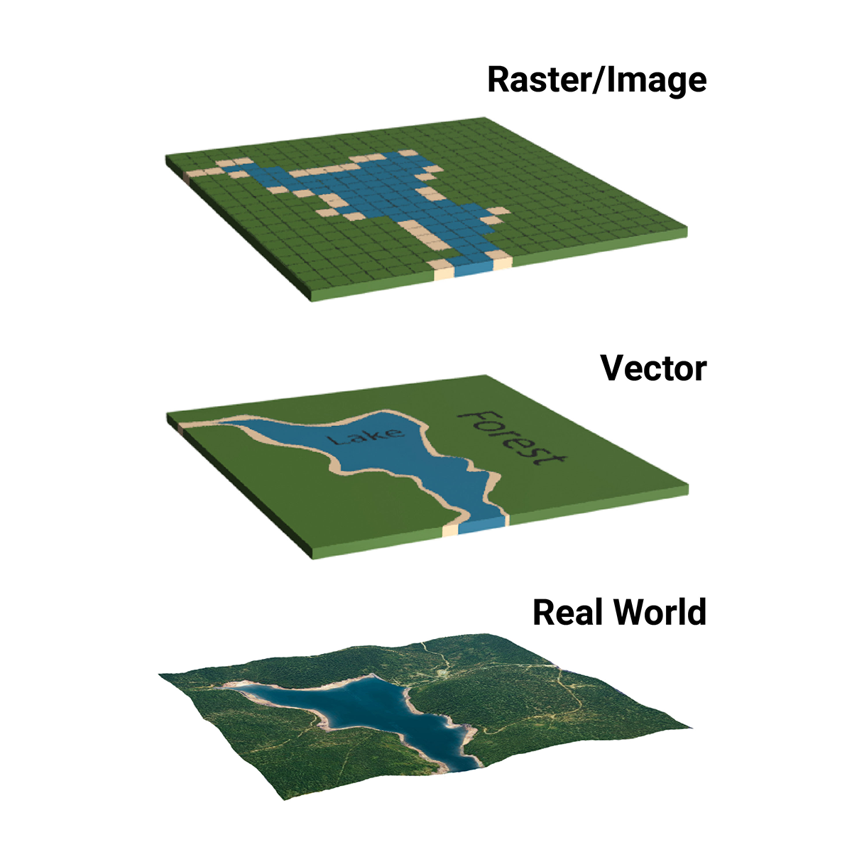
Raster and Vector data types as representative of 'real world' geographic space.
Vector and raster data, what is it and why does it matter?
There are two main formats Geographic Information Systems (GIS) data can take — vector and raster. You will work with these two types of data no matter what software you choose.
Vector data is a point, line, or polygon based on a coordinate. It is one-dimensional. Roads, rivers, and Native Title borders are all examples of vector data. Raster data is a digital photograph. Raster data is is made up of square grids of pixels. Raster data is useful because it can show changes over time, height and temperature. Google Earth Engines timelapse of bushfires in Yellabinna, South Australia is an example of raster data.
Common vector files
KML (Keyhole Markup Language) - KML files are plain text files that contain XML tags (XML = data). KML files are used to display geographic data and you will come across them in software like Google Earth. Check out this resource from Google’s developer team to learn more about KML files.
KMZ (Keyhole Markup Language Zipped) - KMZ files are compressed zipped files. They can hold many KML files that have been reduced to a smaller file size. This makes them easier to move to different locations via email, Google Drive, or USB as they don’t demand much computer processing and can therefore be transferred quickly.
SHP (Shapefile) - Although originally developed by Esri for ArcGIS Pro software, shapefiles can be used across many different mapping softwares. A shapefile is similar to a KMZ file in that it stores multiple sets of data files within it (you will find SHX and DBF files within your shapefile along with other file types. These additional files store the location and information about geographical features. It’s important to note that you do not want to delete any of the files within your shapefile. This can ‘break’ your data and make it unusable.
XML (Extensible Markup Language) - XML tags are just another way to describe data. XML tags create the features you see in Google Earth Pro like placemarks, ground overlays, paths, and polygons. You may also find yourself using KML files across ArcGIS, QGIS, and other mapping software
Common raster files
JPEG (Joint Photographic Experts Group) - JPEG is an image file. In mapping-related projects, you may find yourself using a JPEG file when you are uploading an image to your ArcGIS StoryMap or needing to save your Google Earth Pro map as a JPEG in the instance you want to share the image of the area you are looking at with a colleague, create a custom table, or print the image out to physically draw on the map.
PNG (Portable Network Graphics) - PNGs are similar to JPEGs except they use lossless compression. IMW Australia’s Indigenous mapping icons are an example of a PNG you may use in mapping!
TIFF (Tag Image File First) - TIFF files are high-quality image files that support georeferencing. If you had taken footage from a drone and used photogrammetry to stitch all the footage together to create an orthomosaic, saving the orthomosaic as a TIFF file would maintain the integrity of the image.
Why learning to map using geospatial software is worth it
Mapping technology can greatly assist those working in land management, language and arts meet their caring for Country obligations in a sustainable way - saving time, money while also ensuring data is safe and secure. This means that efforts to protect and care for land, sea and culture are maximised.
The Indigenous Mapping Workshop teaches Indigenous-led organisations to use mapping tools to collect, host, visualise, share and publish maps to support their various community objectives. If you are interested in learning to map in Google Earth Pro, QGIS or ArcGIS, apply to access IMW Australia - On Demand.