Mapping Country in 3D just makes sense. Here’s why.
Indigenous Elders across Australia have an extensive knowledge of the landscape and an understanding of Country that cannot be captured on traditional two-dimensional (2D) maps.
In 2D mapping, there are two coordinates we use: X and Y. But now, we can leverage three-dimensional (3D) geographical information systems (GIS) to introduce a Z-value into the mix.
When we map Country, the most important data comes from traditional owners and elder’s rich knowledge and intimate understanding of landscape. This understanding comes from generations of observation and knowledge about Country, the ecosystem and the interaction of people and place.
The Z-value hosts this cultural knowledge and if tapped, has the ability to increase the depth and accuracy of a project. This added level of complexity is imperative for both displaying Indigenous information, and for working collaboratively with Indigenous elders to accurately identify intricacies of landscape and produce richer mapping products.
Viewing maps through a human-focused perspective
The human body is known to be its own tool in understanding human behaviour, it is logical to also use it as a proxy for viewing the activity of previous humans. 3D GIS visualisation allows Country to be mapped from a viewpoint that elders can identify and are familiar with.
Knowledge holders are able to impart their knowledge accurately and collaboratively when using technology that is centred around their own human experience.
Cartographic languages do not easily translate to Indigenous knowledge and experiences within the landscape, and mapping Country using these methods poses the risks of miscommunication and misrepresentation of data.
Digital reconstructions of Country using 3D technology also provide Aboriginal people and GIS professionals with a framework for performing simulations. These simulations create a shared spatial language, deep collaboration, transparency and diffuse a power relationship whereby Elders and traditional knowledge holders are able to communicate more efficiently and with a greater sense of focus on issues that matter.
A multi-sensory experience
3D GIS visualisation provides us with more than just one way of seeing the map. It adds depth to the human experience by enhancing the sight, auditory and embodied experience - providing a multi-sensory way of understanding landscapes.
For example; integrating 3D GIS technology with photomesh models captured by drones increases the visual connections that can help to replicate a near physical environment and enhance the sense of sight. This allows a map reader to better understand how objects are experienced in real life as opposed to only understanding their positioning within a space.
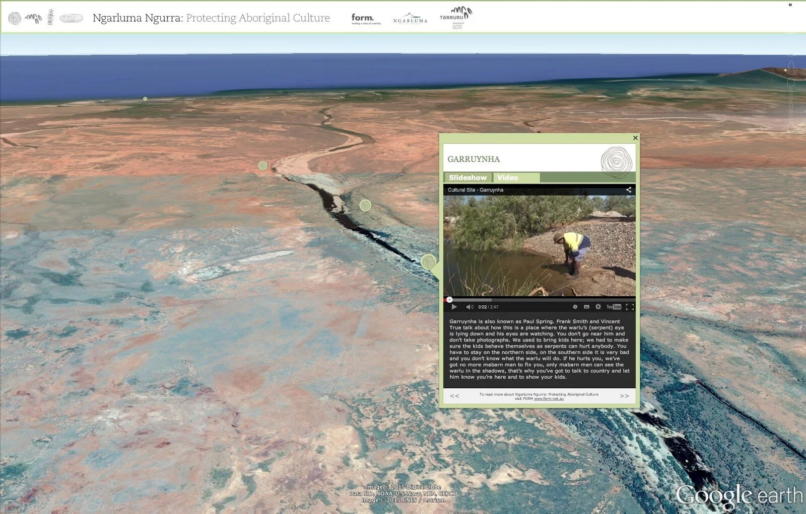
An example of audio-visual assets placed within 3D GIS technology
The multi-sensory experience is also enhanced within 3D GIS through the use of 3D Scans that produce accurate Point Cloud Models. Point Clouds are sets of data points that represent a 3D shape or feature in the landscape. When we map Country, these Point Clouds produced by photogrammetry software or 3D scanners, model important heritage sites such as rock shelters.
Further, 3D GIS is a digital home for multimedia assets. These multimedia assets such as text, audio, still images, animation and video, share detailed cultural knowledge and provide context for specific locations. Multimedia assets encourage map readers to explore their senses beyond just sight and listen to the knowledge held by elders.
The introduction of Virtual Reality (VR) technology further propels the capabilities of 3D GIS visualisation. VR technology allows both map makers and map viewers to immerse themselves in the mapped environment and take part in knowledge exchange, or reconnect with an area that is inaccessible.
3D GIS and mapping Country in practice
Land and Coastal Modeling and Analysis
Coastal areas are gateways for international trade, so their management is crucial to keeping threats (environmental and man made) at bay. 3D GIS aids the process of designing work plans when working with knowledge holders. These work plans are useful both internally and externally for Indigenous Ranger Groups and Native Title Organisations who manage and analyse both land and coastal areas.
Rock Art and Rock Shelters
Different generations of rock art are frequently found on different elevations of rock shelters. Using 3D technology to map these cliff faces ensures that each generation of rock art is correctly identified, and not bundled into one site as is often unavoidable with 2D mapping.
Industry and Community Consultation
When there are pressures on the land, such as mining exploration or other industry pressures, it is much easier to comprehend distances, explain the landscape and communicate what needs to be protected when using 3D GIS technology.
The shift to the high-quality Digital Elevation Models from traditional 2D mapping is changing conversations about what is happening on the ground, and enhancing the clarity of these consultations.
3D Modeling
Building information modeling (BIM) is a technology that develops digital elevation models (DEM) of facilities and their processes - otherwise known as a ‘digital twin’. DEMs have rapidly advanced in recent times and work by draping the landscape onto these digital twins using satellite imagery.
Winyama has unique skill sets in 3D visualisation for heritage mapping. We would love to hear from you to discuss your next project.
Winyama specialises in Geospatial Solutions, Cloud Solutions, and Drone Solutions. To look deeper into our services click on the tab in our home page.

