

Newsroom
The far reaching impact of Indigenous procurement
The Indigenous Procurement Policy (IPP) stimulates Indigenous entrepreneurship, business development, economic engagement and has positive flow-on effects to communities that surround the Indigenous-owned and operated organisation you are looking to employ.

Winyama trains Pilbara-based ranger groups in cultural land management and spatial technology
The Winyama team were invited to Port Hedland to discuss the development of the new Pilbara Cultural and Land Management Project (PCLMP).

What is First Nations Earth Observation?
The Indigenous Mapping Workshop Australia and its partners, seek to create a community of digitally empowered Aboriginal and Torres Strait Islander people who want to learn about Earth Observation and get involved in the wider Earth Observation community.

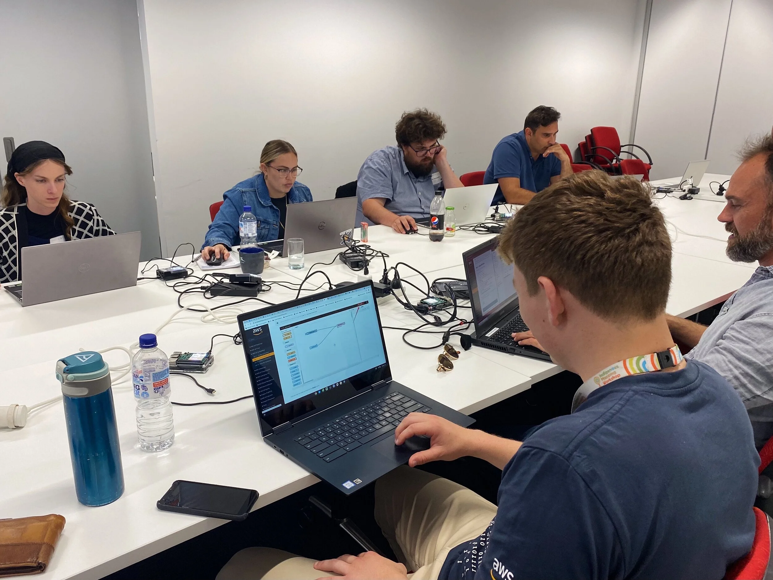
Getting started with drone mapping
If you belong to a ranger group or manage a large expanse of land, using a drone to survey and collect data can be a low-cost and effective way to assist in caring for Country. Read our practical tips and find resources here to get you started.

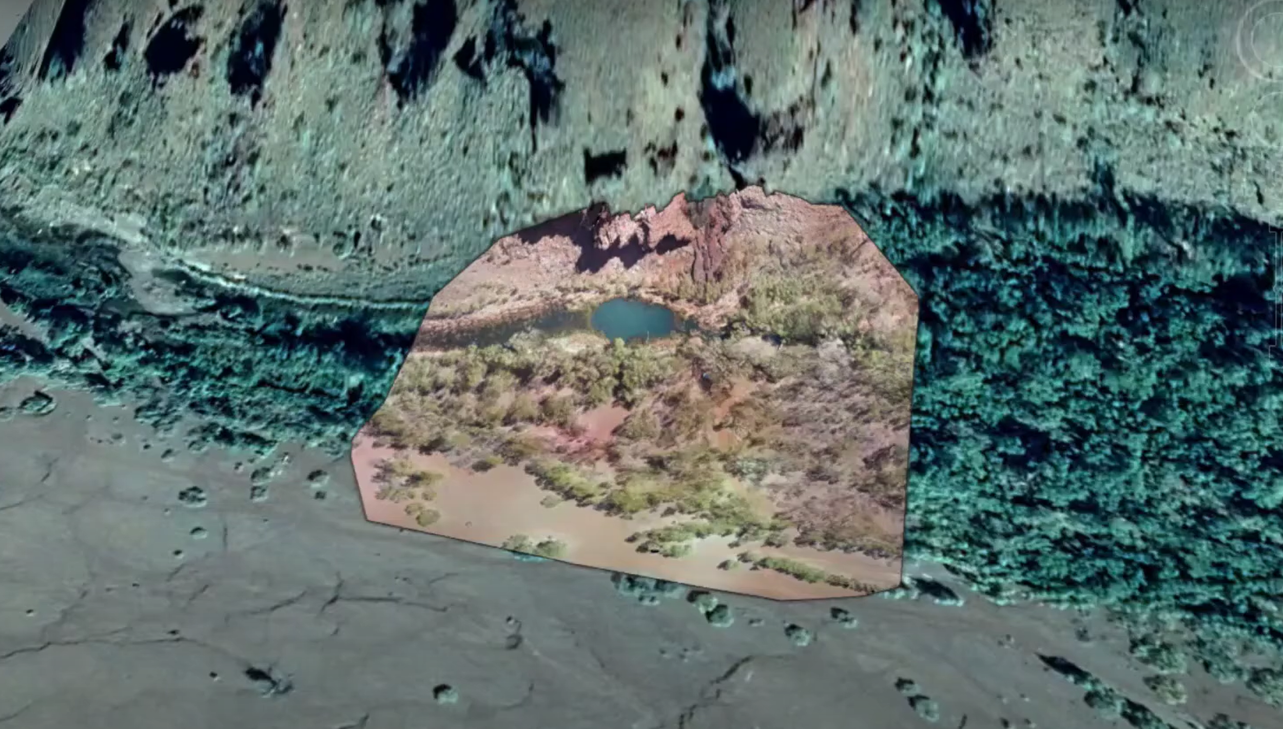
Mapping in 3D transforms heritage consultation for Indigenous communities
Our team at Winyama has developed the capability to streamline the process of knowledge sharing. Through the use of powerful 3D GIS visualisation technology; we are enabling mining companies and Traditional Owners to have productive and transparent discussions about impacts to lands and waters.

Fulcrum and Winyama announce partnership to service Indigenous Ranger Programs
Winyama and software company Fulcrum announce a strategic partnership to deliver location-aware applications to Indigenous ranger groups.

Winyama team delivers IMW training to remote communities in the Kimberley
Read about the newest installment of the IMW Australia, the Regional IMW Australia in which the team ventured to the Kimberley over a number of weeks to teach valuable geospatial and drone skills to remote Indigenous ranger groups.

#WhyIMap: Using experience to benefit others
Explore the journey of a past IMW participant to becoming an employee and course author for our online learning portal IMW Australia - On Demand.

Digital Twins and Heritage Mapping
Learn more about how Digital Twin technology is revolutionising the way we map heritage.

Hearing history through maps
Winyama and the University of Melbourne’s Hearing Histories West Pilbara Project, is an accessible online resource in development for mapping archived recordings of Aboriginal Tjabi traditions. Learn more about it here.

Participants to presenters: Willowra Community hosts mapping workshops
IMW Australia 2019 attendees from Willowra community used their scholarship funds to host two intensive digital mapping workshops in Alice Springs. Find out more.

“Indigenous maps can protect areas for the future” - Elisha Jacobs-Smith
Hear from regional IMW attendee, Elisha Jacobs-Smith, to learn about how his newly acquired skills will benefit him into the future.

A new data partnership with national scope
The Winyama team is excited to formally announce our partnership with the University of Melbourne’s Indigenous Data Network (IDN) — a collaboration connecting two organisations that share the same vision.
I’ve got drone data, now what?
Unmanned aerial vehicles (UAVs), or drones, are becoming an increasingly popular way of visualising and monitoring landscapes. Read different ways that you can begin incorporating your drone imagery data into your Geographic Information Systems (GIS).

Winyama hosts first regional Indigenous Mapping Workshop
Winyama hosts the first face-to-face Indigenous Mapping Workshop (IMW) Australia since the previous flagship event in 2019. As a part of the new ‘Regional IMW’ program, this pilot event brought together Indigenous Rangers from the Department of Biodiversity, Conservation and Attractions’ southwest and midwest regions.
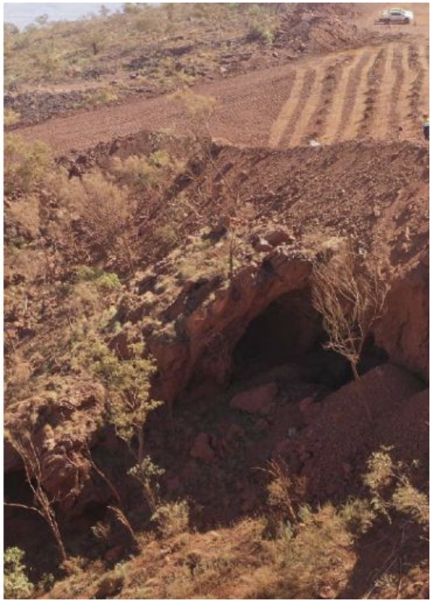
What do the Juukan Gorge recommendations mean for me?
The Joint Standing Committee on Northern Australia has said ‘Never Again’ along with a number of recommendations shared in the interim report for the Inquiry into the destruction of Juukan Gorge. Find out how they relate to GIS and what they mean to you.

Collecting and Visualising Learner Data with Google Data Studio
Inbuilt data visualisation tools can often come with challenges and limitations. We have broken down why using tools like Google Data Studio are beneficial for visualising crucial educational data.
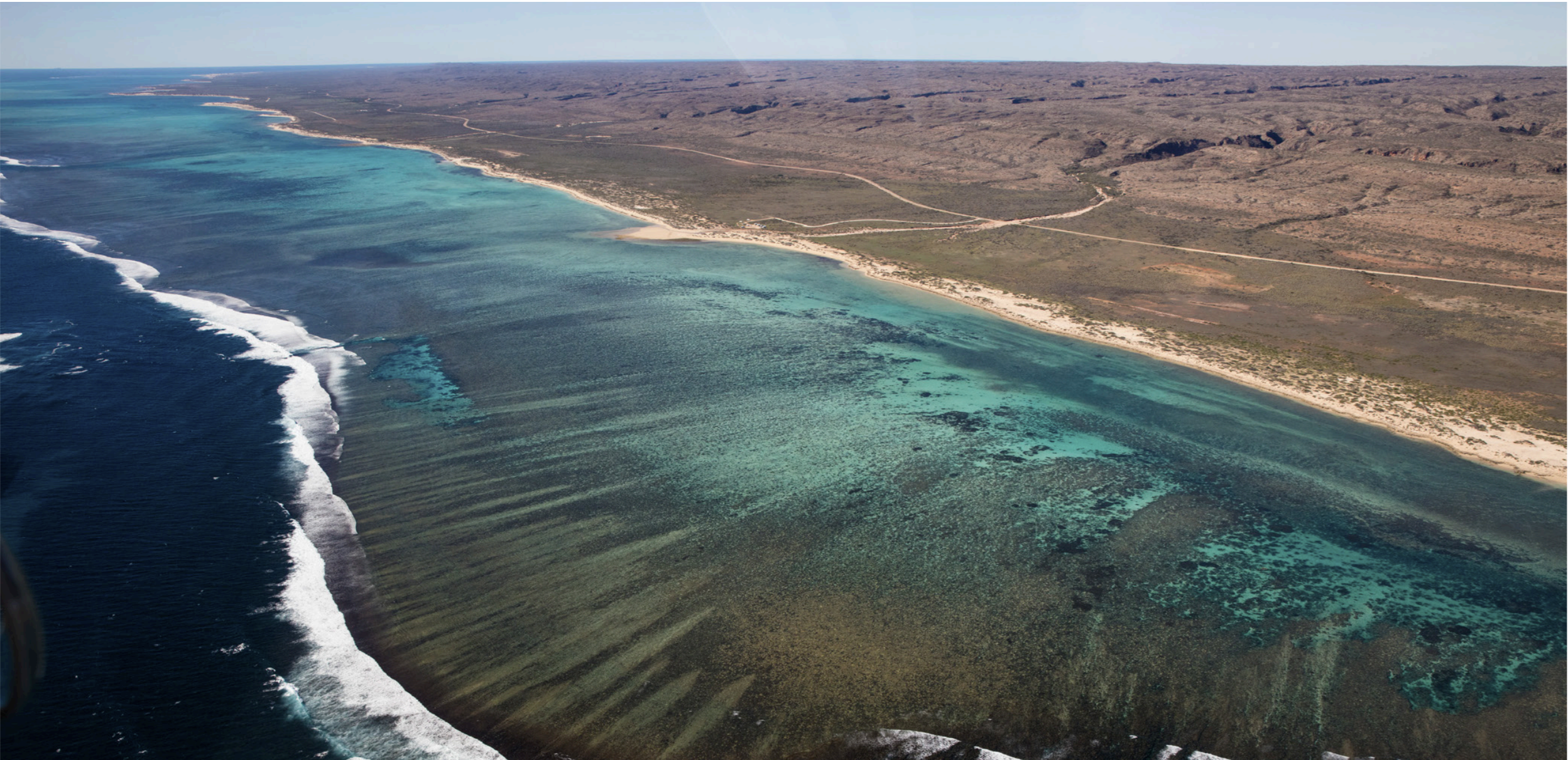
Plan for Our Parks and Aboriginal employment
Plan for Our Parks is a Western Australian Government initiative that has established long-term management and co-management agreements with Indigenous groups to increase conversation. Read more about how this program impacts Indigenous Rangers and Native Title organisations.

How spatial strategy can help your Native Title business
For all industries working in areas of land tenure, having a spatial strategy is one of the most beneficial things you can do. Here we explain why you should be thinking about your own spatial strategy, how it relates to Native Title, and why it is so important.
How the IMW is addressing UN sustainable development goals
At Winyama, we are committed to addressing the UN’s Sustainable Development Goals through our delivery of the Indigenous Mapping Workshop Australia. Find out how.